Let op: onze fysieke winkel in Elst is op vrijdag 3 januari gesloten.
- Voor 15:30 besteld, zelfde werkdag weg
- Verzending slechts € 2,95 (NL)
ITM El Salvador & Guatemala South
ITM El Salvador & Guatemala South
€ 13,90
-
Lang leve de specialist
Alles wat wij doen en verkopen is fietsvakantie-gerelateerd.
-
Fietsen maakt het hoofd leeg en het hart open
Even niet presteren. Beginnen, en de rest komt vanzelf op je af.
-
Eenvoudig gelukkig is gelukkig eenvoudig
Misschien wel de grootste rijkdom van een fietsvakantie.
Productomschrijving
Video Product
Productomschrijving
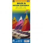
ITM El Salvador & Guatemala Zuid - 1:270.000 / 1:457.000
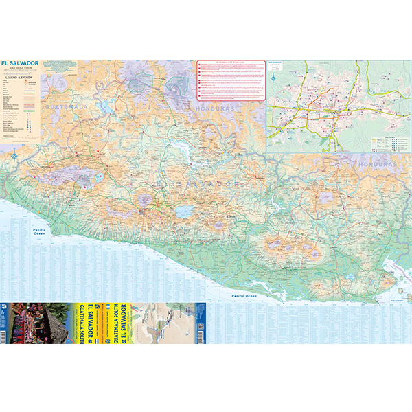
Als er voor een land of streek helemaal geen kaart meer te vinden is om te fietsen dan hebben we gelukkig altijd nog de ITM-kaarten (International Travel Map). De schaal lijkt voor de fietser te grof, er kan echter goed mee gefietst worden. Meer wegen dan op de kaart staan zijn er meestal gewoonweg niet, zelfs de dirt-roads zijn meestal nog terug te vinden. Veel kaarten zijn inmiddels waterbestendig. Hoogte wordt aangegeven middels kleurvlakken.
Over de kaart van El Salvador & Guatemala Zuid
This is a double-sided map with the El Salvador (1:270.000) on one side, along with a detailed inset map of San Salvador. The maps also shows the country's World Heritage city of Chalchuapa, dating back 3,200 years. The other side of the sheet is a completely separate maps of neighbouring Guatemala, being a detailed map of the central southern portion (1:457.000)of this important country. The highlights shown on this map are Quetzaltenango, Antigue Guatemala, and the Mayan ruins of Quirigua, dating from 200ad. The border crossings with El Salvador are clearly shown and are easily crossed.
Hoofdkenmerken op een rij
| Schaal | 1:270.000 / 1:457.000 |
|---|---|
| Taal | Engels |
| Uitgever | itm |
| Jaar van uitgave | 2019 |
| Artikelnummer | 703802 |
| EAN / ISBN | 9781771292610 |
Reviews
Schrijf uw eigen review
Andere producten die mogelijk iets voor u zijn!