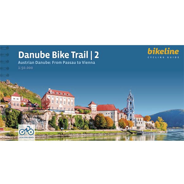
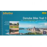
Danube Bike Trail 2 Bikeline Fietsgids
Danube Bike Trail 2 Bikeline Fietsgids
-
Lang leve de specialist
Alles wat wij doen en verkopen is fietsvakantie-gerelateerd.
-
Fietsen maakt het hoofd leeg en het hart open
Even niet presteren. Beginnen, en de rest komt vanzelf op je af.
-
Eenvoudig gelukkig is gelukkig eenvoudig
Misschien wel de grootste rijkdom van een fietsvakantie.
Productomschrijving
Video Product
Productomschrijving
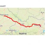
Danube Bike Trail 2: From Passau to Vienna - 320 km
De fietsgids
De Bikelineboekjes zijn al jaren zeer geliefd bij onze klanten. En terecht! Het is een zeer handzame ringband met zeer gedetailleerde fietskaarten en indien nodig stadsplattegronden waar de fietsroute ook op ingetekend is. Geen gezoek in de grote stad dus. Ook zijn, indien relevant, diverse hoogtegrafieken aanwezig.
Hiernaast vindt u zeer uitgebreide toeristische info en alle overnachtingsadressen met nauwkeurige prijsindicatie. De adressen staan op volgorde van de route. Ook campings zijn terug te vinden in de lijst. De route is twee kanten op bewegwijzerd. De meeste fietsers combineren deze bewegwijzering met de heldere kaartjes. Her en der zijn er altijd bordjes weg natuurlijk. De fietsgids past bijzonder mooi in de Ortlieb-kaarthoes.
gps-track Voorin deze fietsgids staat een code waarmee u op de site van Esterbauer heel eenvoudig de GPS-track kan opvragen. U hoeft alleen de code en uw emailadres in te geven. Ongelofelijk dat ze het kunnen maken, zo'n kwalitatief goede fietsgids voor nog geen 20 euro.
Engelstalige beschrijving van de route van de site van Bikeline
In the last decade the Danube bike trail has emerged as Europe’s most important long-distance bicycle touring route. Its popularity is due primarily to the Danube’s natural beauty and the wealth of cultural and historical sites that line its banks. But the large numbers of bicycle tourists visiting the Danube would not be possible without well-developed infrastructure and services. The Danube bike route has benefited from well-built posted bike trails and an extensive network of services oriented to meeting the needs of bicycle tourists. The following pages provide a few practical notes about how to use the book, and some tips on getting ready for the tour.
Gps-track
Voorin deze fietsgids staat een code of link waarmee u op de site van Esterbauer heel eenvoudig de GPS-track kan opvragen.
Wijzigingen
Klik op de button hieronder voor de laatste wijzigingen op de site van de uitgever Esterbauer:
Digitaal bladeren in Bikelinegids. Incl. routeoverzicht (pag.1) en hoogteprofiel:
Klik HIER
Info, zwaarte en wegkwaliteit: Alle info op een rij:
Beschrijving van de site van Esterbauer
The Length
The total distance from the start in Passau to the final destination, Vienna, is 320 kilometres. This figure does not include about 160 kilometres of side-trips and alternative routes.
Surface quality and traffic
The Danube bicycle route is very comfortable to ride. Virtually the entire distance follows paved bicycle paths or lightly traveled public roads. For most of the distance, a bicycle route is present on both sides of the river.
ADFC classification
The Danube bike trail was given a 4-star classification by the ADFC in March 2012. The ADFC (General German Bicycle Club) inspects long-distance cycling routes and rates them on a 5-Star scale, assessing criteria such as route quality, safety and signage, as well as gastronomy, accommodation and access via public transport. The classification is valid for only 3 years.
Signage
The Danube bicycle route is thoroughly signposted to show the way. However, it does occasionally happen that signs are missing or turned in the wrong direction. In Austria, rectangular green signs are posted along the route and in most places the route is clearly labelled the “Donau-Radweg.” Other regional bicycle trails branch off from the main route. Excursions and alternative routes often follow their own signs, and are also described in this book.
Hoofdkenmerken op een rij
| Schaal | 1:50.000 |
|---|---|
| Taal | Engels |
| Schrijver | Bikeline |
| Uitgever | Esterbauer |
| Jaar van uitgave | 2023 |
| Artikelnummer | 000302 |
| EAN / ISBN | 9783711101693 |

